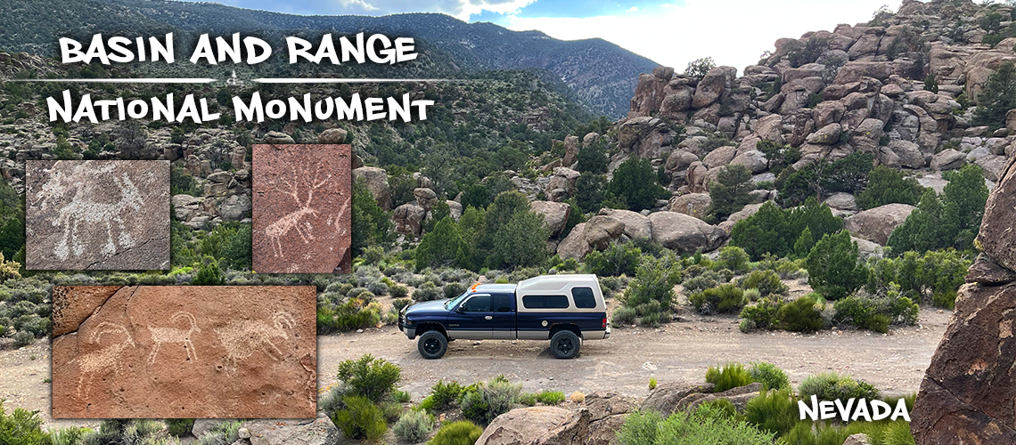
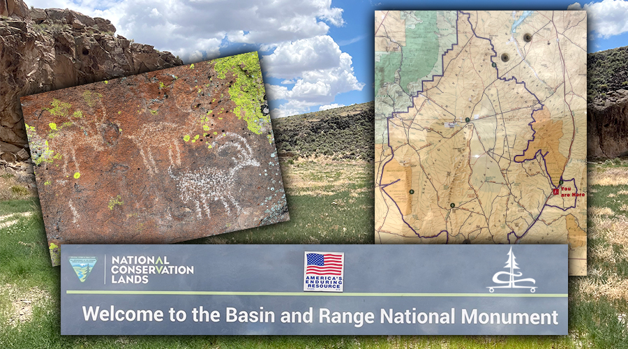
Basin and Range National Monument | Amazing Petroglyphs and Scenery
Basin and Range National Monument encompasses 704,000 acres of – the monuments namesake – basin and range landscapes. These landscapes are made up of alternating steep narrow mountain ranges separated by wide basins with elevations ranging from about 4,200 – 8,900 feet. Here you’ll find fascinating geology and rock formations as well as an incredible diversity of plants and animals. And Basin and Range National Monument has one of the best collections of petroglyphs we have ever seen.
With minimal development as far as trails and recreation sites go, it can be intimidating to know where to even start exploring Basin and Range National Monument! So we decided to start with the few sites that are “developed”. This gave us a couple of destinations to shoot for, while also allowing us to become more familiar with the landscapes, distances and just getting some sort of spatial awareness of the massive area.
Read on to find out more about what we found on our trip to Basin and Range National Monument. And feel free to use the links below to skip around throughout the article.
Keep in mind, this national monument is largely undeveloped with no paved roads, minimal cell signal and no services. Make sure you are prepared.
Before You Go: There are a couple brochures on the BLM website that are really helpful to download ahead of time! Here’s the link to the brochure that identifies some of the main petroglyph sites found in Basin and Range National Monument.
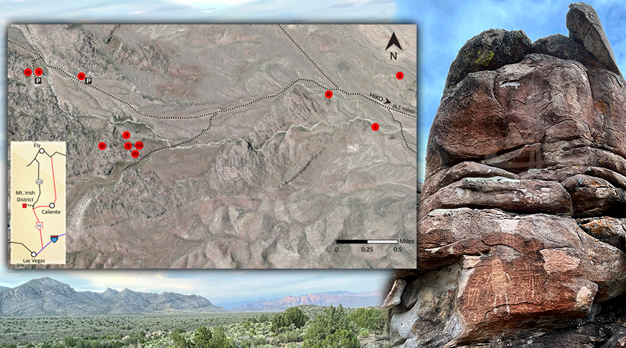
Map of Basin and Range National Monument
White River Narrows Archaeological District
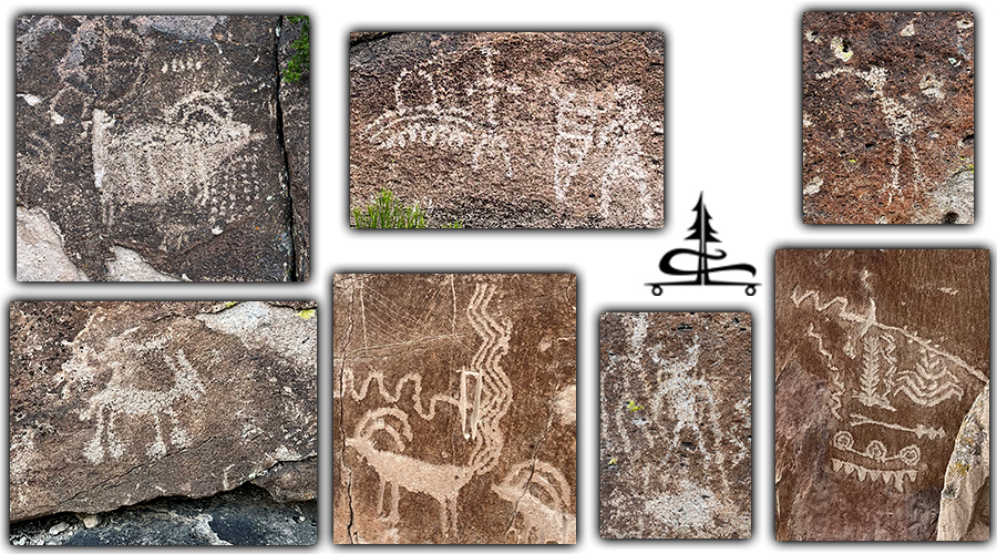
Our first stop in Basin and Range National Monument was the White River Narrows Archaeologic District. Here you can find six main petroglyph sites within the scenic canyon that was shaped by the White River long ago. These petroglyphs are of Basin and Range tradition as well as Fremont tradition.
Th White River Narrows petroglyphs brochure that we downloaded ahead of time was full of interesting information about the history of the six different rock art sites. And it also had a helpful map that helped us to spot the main petroglyph panels in the area.
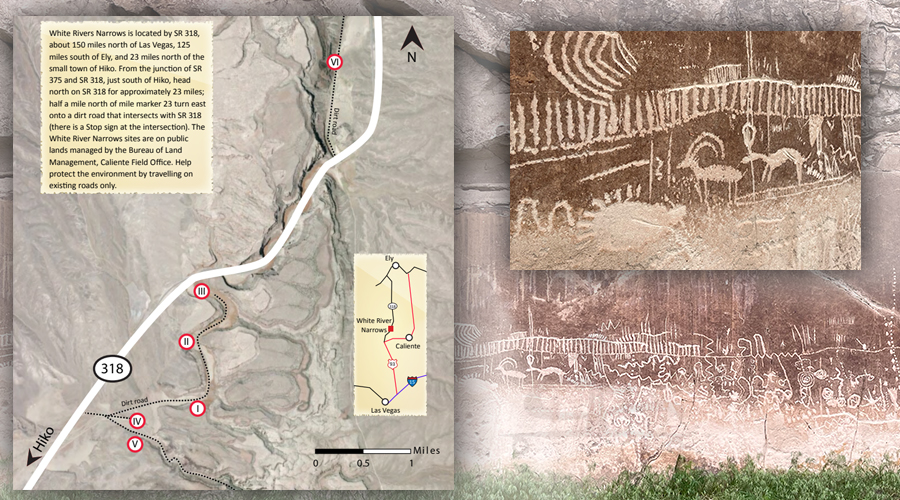
We enjoyed following the single track road as it meandered into the canyon as we kept our eyes peeled for signs of rock art. It felt a lot like a scavenger hunt.
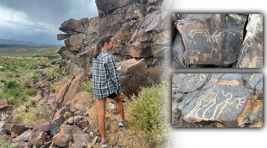
After checking out the petroglyphs at sites one through five, we headed north on the highway to visit site six. I would say site three and site six were my favorite petroglyphs at the White River Narrows location. Site six had sooo much to look at!
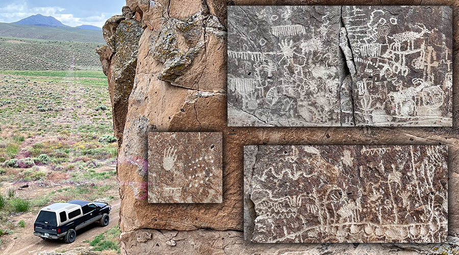
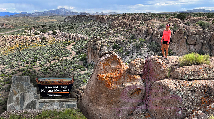
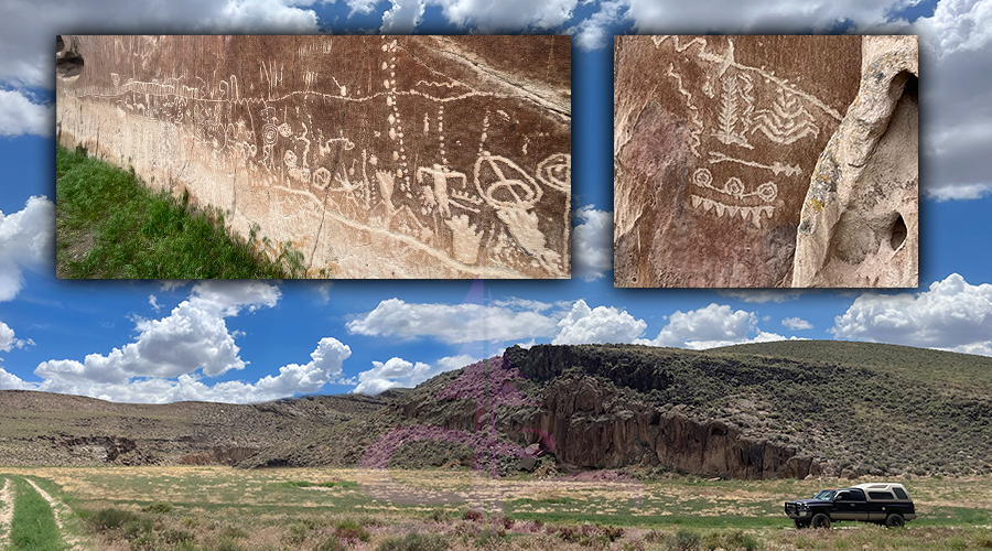
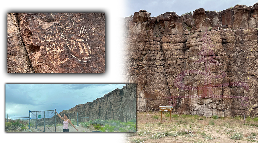
A Quick Stop in Weepah Spring Wilderness
After a cool adventure checking out the White River Narrows petroglyphs, we drove south on the highway about a mile or so from site six. We turned onto Weepah Spring Road on the right (west) just to see what what back there. Once through the gate we saw the sign indicating that we had entered Weepah Spring Wilderness. We continued along the dirt road to the large boulder near the small parking area.
So we parked and started to check out the rocks when we began noticing more petroglyphs. Here’s one, here’s some, here’s one! It started sprinkling and we had more planned to see in Basin and Range National Monument so we continued on.
Liking this article? Pin it!
Drive Up Seamans Road in Basin and Range
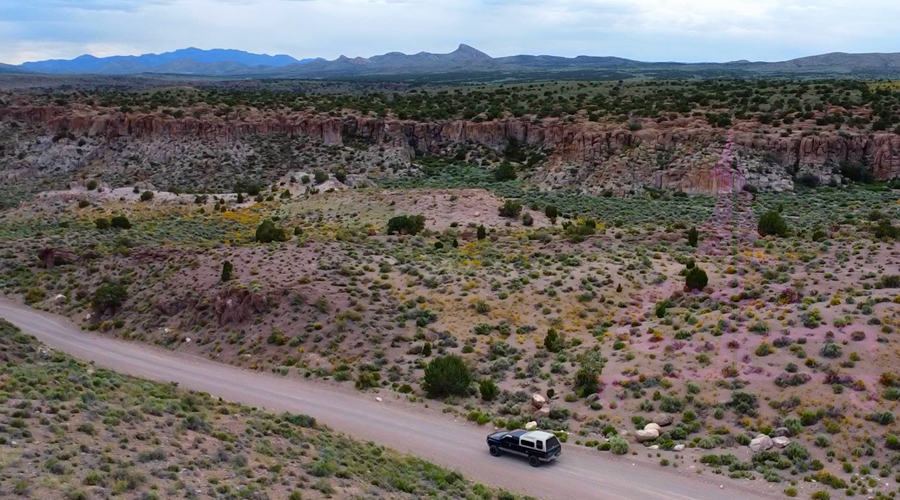
On our drive from White River District to Mount Irish District we took a side trip down Seamans Road. This dirt road is wide and in great condition with a slight washboard effect. As you turn in, there’s a Basin and Range National Monument sign with information and a map of the area.
We drove along Seamans Road heading west enjoying the scenery and taking in an area completely foreign to us. Eventually, we reached the Seaman Narrows which was just a part of the road that cuts through the rock creating a short little canyon-like drive.
Once we were on the other side of the Seaman Narrows, we couldn’t help but continue a little further. The scenery was vast and the wildflowers were beautiful, then up ahead there were some really cool columnar rock formations. As we approached the top of the pillars we found a side road to turn off onto so we could get out and explore a bit.
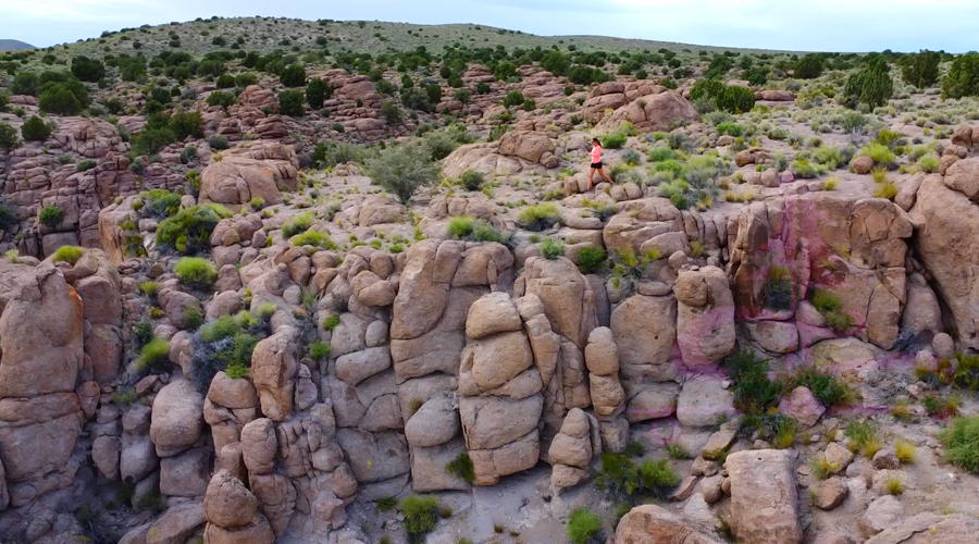
This rocky area was a really cool site to check out and it made us wish we had more time to explore! Basin and Range National Monument is so huge and varied that we know we have to come back with more time in the future. This is just one road in the monument but it looks as if it holds various opportunities for adventure among beautiful scenery and solitude!
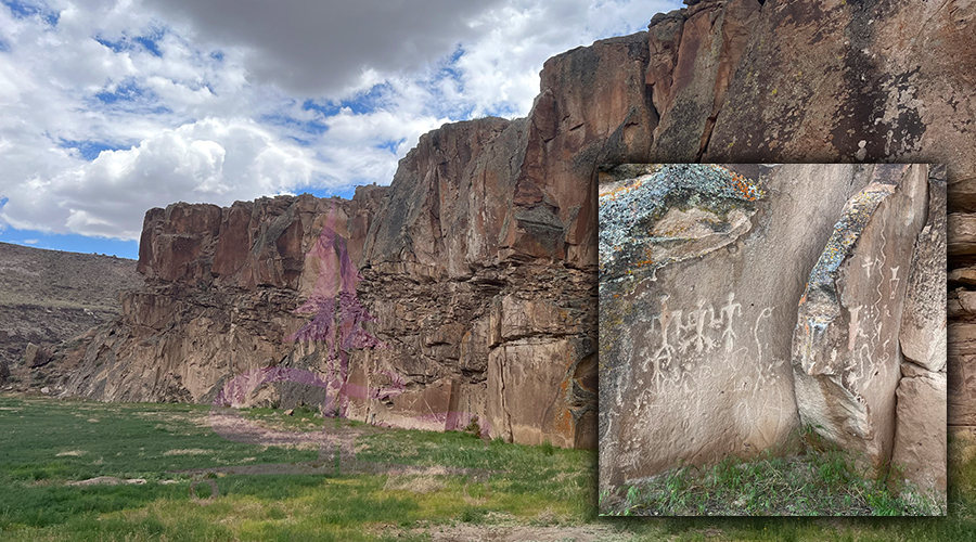
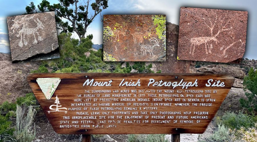
Mount Irish Archaeological District
Next stop in Basin and Range National Monument was the Mount Irish Archaeological District. This is another major petroglyph site.
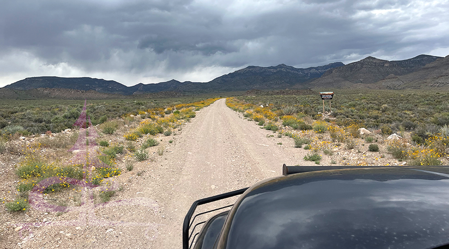
To access Mount Irish Archaeological District, we headed south on NV-318 and then turned right onto Irish Mountain Road.
First, there’s a unruly, floppy fence to deal with but once you get that opened and closed, it’s a straight shot back to the Mount Irish Wilderness. This dirt road is in good shape, passable in any standard vehicle though a bit bumpy. And that made the 6.5 miles back to the petroglyph sites feel much longer.
Again, there is a brochure that you can download online that will help you spot the major petroglyph panels in the Mount Irish Archaeological District. We found it very helpful. Here is a map of the Mount Irish District major sites of petroglyphs in Basin and Range National Monument.
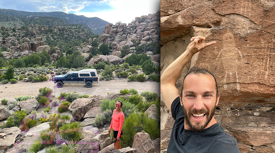
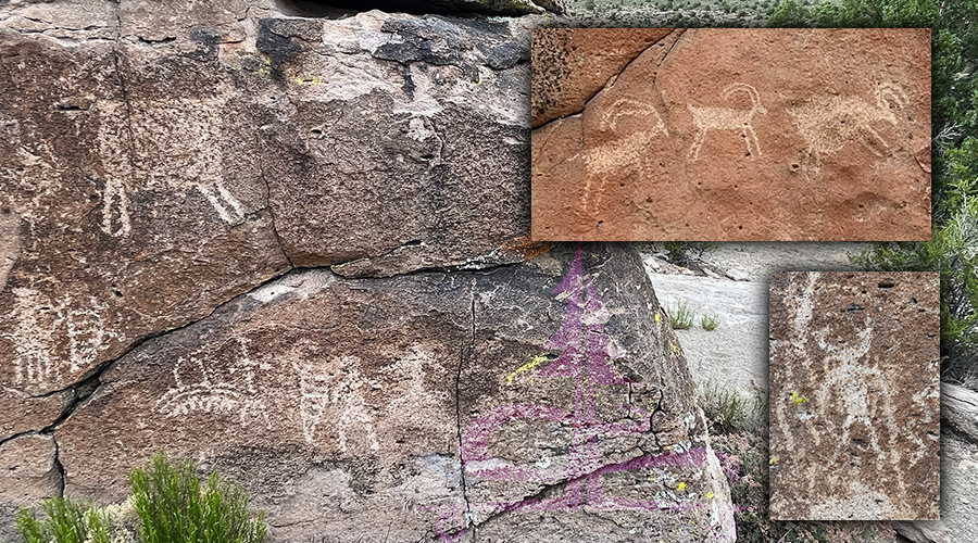
We stopped at site 3, starting back in as far as we could then worked our way out leaving out sites 1 and 2. There’s just not enough time in the day! Since the rock art speaks for itself, I’ll show some of what we found in the Mount Irish Archeaological District in Basin and Range National Monument.
Mount Irish Wilderness (just a quick side note that I would have found useful before this trip)
So, I have not explored the Mount Irish Wilderness but now that I have laid my eyes upon it, I have been exposed to what’s there. And I must say, it looks awesome! After checking out a few sites in Basin and Range National Monument, I know that I would love to return to the Mount Irish Wilderness.
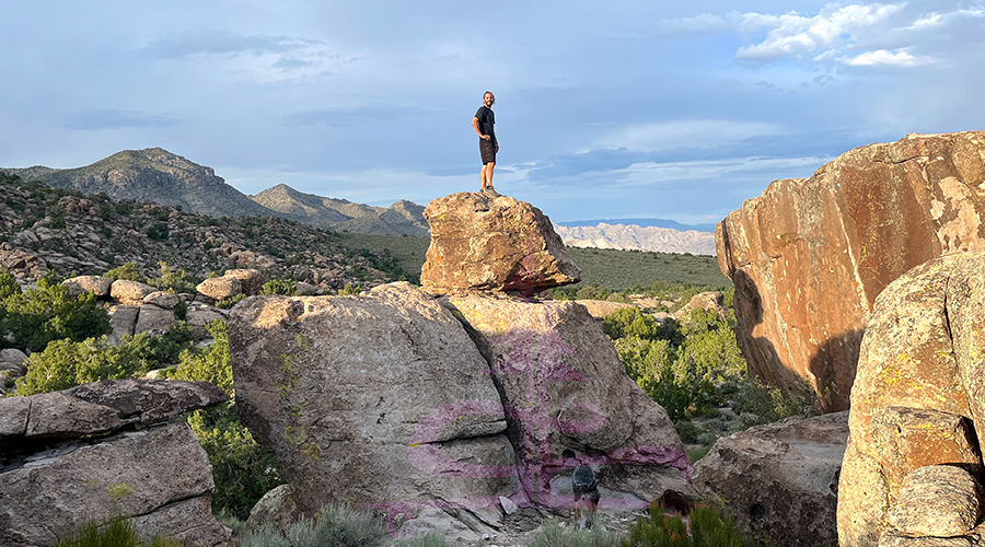
Once we made it back into Mount Irish Wilderness area we were amazed by the beauty! This is definitely an area that I’d like to explore deeper. As far as landscape goes, it’s perfect – endless boulders, valleys, mountains and pure adventure. There’s a great mix of vegetation, from cacti and yucca to junipers and pines. And the petroglyphs are just the icing on the cake. Even the rocks on the ground as we were walking were eye catching – so unusual and colorful.
Also, I would say that if you’re stuck choosing between Mount Irish Archaeological District or White River Narrows Archaeological District, I personally would lean towards Mount Irish. The petroglyphs at both sites are incredible! But I loved the adventure feel of checking out the petroglyph sites at Mount Irish Wilderness.
Thanks for Reading About Our Adventure in Basin and Range!
I know, we haven’t even scratched the surface of exploring Basin and Range National Monument. But we saw some really cool stuff and already have ideas of where we want to go on our next visit! We had an awesome day of exploring somewhere unfamiliar – which to me, is a feeling like no other. Stay tuned for more adventures from The Lost Longboarder!
Check out the links below to see some of our other adventures:
- Hiking to Sierra Butte Lookout Tower
- Exploring Gold Butte National Monument
- Best Hikes in Lassen Volcanic National Park
- Hiking Mt. Shavano – 14,229′
While we are on the road we stay busy creating hand painted longboards! If you’d like to pick up a unique new longboard, head over to our Lost Coast Longboarding Shop to see our latest lineup. We also design and screen print our own t-shirts and long sleeve shirts.
Thank you for your support. If you shop on Amazon, you can help us out by using our link to get to Amazon. Then shop as you normally would! It won’t affect your shopping experience but it helps us out. We appreciate it.


You May Also Like
Watson Lake Hiking – Flume and Watson Dam Trailhead
Hiking West Branch Trail to Island and Crater Lakes | Rawah Wilderness